About this case study
Bushfire
Community groups, local councils, households, small business
Emergency management, community engagement
Find out how Ku-ring-gai Council engaged local communities in learning about and preparing for bushfire risk using computing technology.
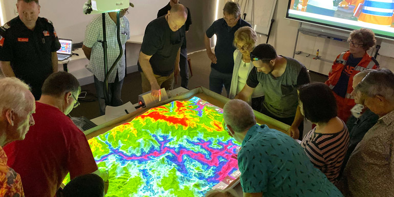
The Simtable is very good at showing people the scale and extent of bushfire risk in an area, how far and how fast bushfires can travel, and why they need to have a plan.
Climate change is increasing the risk of bushfire throughout NSW. Hotter, drier conditions are producing more extreme fire danger days with Greater Sydney experiencing “catastrophic” fire conditions for the first-time last year.
Yet the community remains largely underprepared for bushfires and few residents have a survival plan.
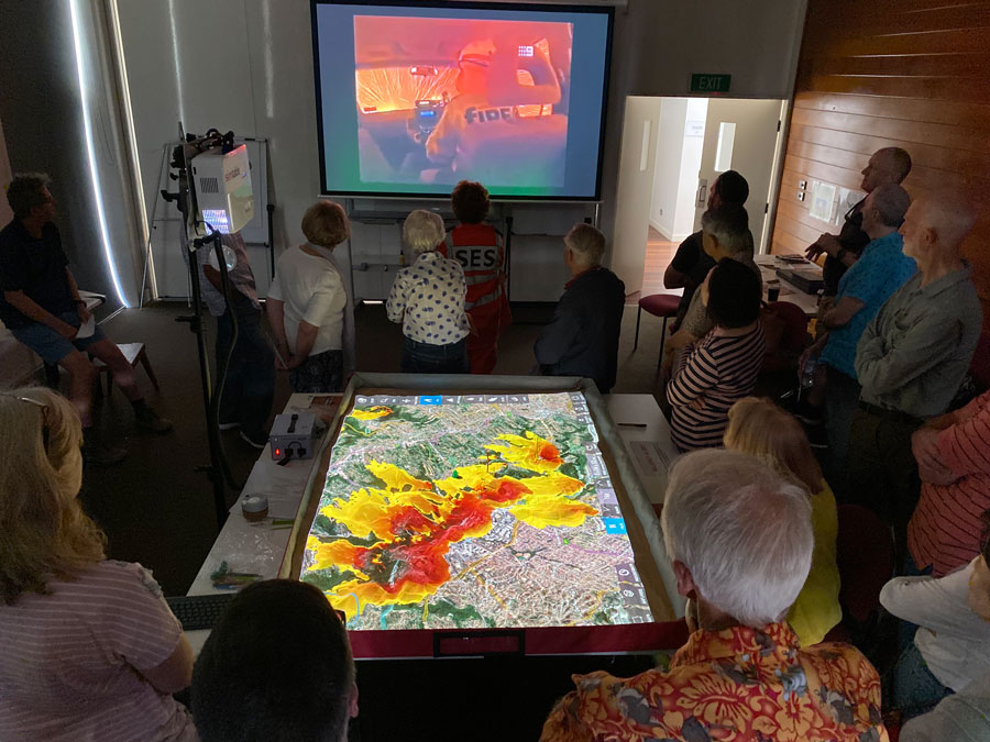
Ku-ring-gai Council has delivered a comprehensive bushfire education program with its Climate Wise Communities workshop series, incorporating computer based simulations to illustrate localised bushfire risk.
The Simtable is a 3D interactive tool that can simulate the impact of bushfire, storm and flooding events on a specific area. Residents recreate the topography of their suburb, overlay it with aerial photos creating the 3D effect, then input weather, fuel and vegetation data to see the potential impact of extreme weather scenarios on their homes and neighbourhood.
This is vital information in Ku-ring-gai where more than a third of homes are located on bushfire-prone land. Steep terrain and extensive ridge-top residential development further exacerbate the danger of bushfires, as does limited road access to some suburbs.
Fire travels faster uphill than it does downhill, when residents look at the Simtable, they can see that they live next to a steep, highly vegetated gully that can bring fire up there. They can see what all the hazards are around and they can understand how the routes out of their area are easily compromised.
- James Chan, Sustainability Projects Officer at
Ku-ring-gai Council
“It’s a great way of dispelling a lot of myths and assumptions that people can fight and stay and defend their homes in this terrain, in this situation. More people are lost trying to leave fires too late than while actually fighting fires.
“The key is to have an early trigger to leave and to make sure that your home is quite resilient to bushfire. A well-prepared house has a far better chance of surviving bushfires.”
Council staff supplemented Simtable demonstrations with a tour of the Climate Wise Communities website, which helps residents evaluate their home for bushfire, storm, flood and heatwave risk and develop a tailored bushfire survival plan. Members of the local RFS brigade and SES offered additional advice to participants on how to respond during fire weather and other extreme weather events.
The Simtable attracted significant media attention and community interest, with many more residents attending the workshops after its introduction. It was also immensely effective. In follow-up surveys, 50% of workshop participants reported that they had written a bushfire survival plan and traffic to the Climate Wise Communities website more than tripled.
The Simtable workshops were so successful, James said, because presenters were able to graphically illustrate bushfire behaviour while using the Climate Wise Communities website to provide solutions to mitigate the risk.
“We find that this approach leaves participants with a ‘can-do’ attitude rather than a feeling of being overwhelmed by the problem,” James said.
“One of the key outcomes from these workshops,” he said, was “to communicate to residents their shared responsibility to their own safety and resilience to extreme weather, especially bushfire.
The Simtable is highly adaptable making it a useful education tool for councils throughout Australia, James said. It is also highly suited to current circumstances, as they were easily able to convert the workshops to an online presentation during the COVID lockdown, he added.
Ku-ring-gai Council is currently exploring other uses for the Simtable including a presentation on storms and flash flooding.
This project was proudly funded by the NSW Government with support from Local Government NSW.
