Key points
- The Metropolitan Sydney region is home to about 5 million people, making it Australia’s largest city. The region is a hub of diverse economic and cultural activity, which contributes significantly to the city, state, nation and the world.
- Climate change is affecting the region, particularly through sea-level rise along the coast, flooding in river catchments, bushfires in forested areas and increased temperatures causing more heatwaves and urban heat islands.
- The environmental, economic and cultural assets of Metropolitan Sydney are highly vulnerable to future climate change. Understanding the region’s vulnerability to climate change is key to adaptation and resilience. The NSW Government, along with local councils, have taken several steps to assessing and planning for climate risk and adaptation across the region.
Importance of the Metro Sydney region


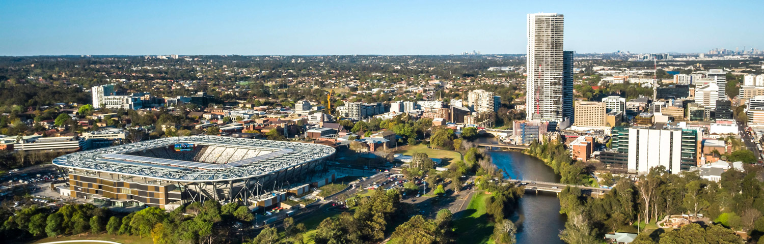
The Metropolitan Sydney region encompasses the traditional lands of the Dharawal, Dharug, Darginung, Guringai and Gundungurra peoples. The region includes major cities, towns and regions, such as Wollondilly, Campbelltown and Sutherland to the South, Blue Mountains to the west, Hawkesbury, and Hornsby and Northern Beaches to the north. To the east the region is bordered by the Tasman Sea.
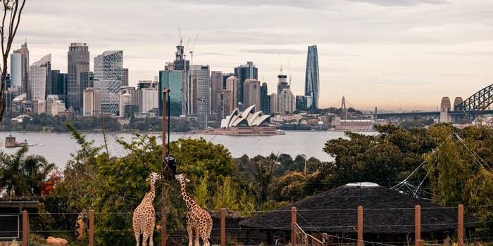
It is Australia’s largest city, home to around 5 million people or about 1 in 5 Australians, and its population is culturally diverse. It has a strong working-age base, which is a higher proportion than the NSW and ACT average.
The Metropolitan Sydney region has a wide range of landscapes, ranging from coastal areas with popular beaches, to the rugged ranges of the Blue Mountains in the Great Dividing Range, to the Illawarra Escarpment to the south. The lower-lying Sydney basin is characterised by wide landscapes with low, undulating hills and river systems. The region includes stunning natural assets including national parks which have cultural and world heritage significance.
The Metropolitan Sydney region supports a diverse range of industries that are vital for NSW’s economy, with the highest number of businesses in construction, specialised services (professional, scientific and technical), property and rental services as well as logistic services. The largest industries of employment for the region are health care and social assistance, specialised services, retail trade, education and training, construction, and financial and insurance services.
These cultural, environmental and economic values are just some aspects of the Metropolitan Sydney region which have been identified as being highly vulnerable to climate change. Climate change is already affecting the Metropolitan Sydney region, particularly through increased temperatures and more extreme weather events. The impacts of these changes can be seen, for example, through the widespread bushfires of 2019–2020, which increased coastal erosion and severe flood events.
The region’s climate has provided the foundation for many of the region’s current social, ecological and economic systems. Now, climate change is altering these foundations, with impacts already visible and expected to grow as they are impacted by increased temperatures, more hot days, fewer cold nights, higher rainfall variability and greater fire danger.
How Metro Sydney is affected by climate change
NARCliM2.0 climate projections at a glance

Climate projections for Metro Sydney are shown relative to a baseline. This consistent reference point (the baseline) avoids the problems that could occur if future projections are measured against a shifting point of comparison, such as a constantly moving 'current' period.
- The baseline period: the modelled average of the 20-year period between 1990-2009.
- Middle of the century (2050): the projected average of the 20-year period between 2040-2059.
- End of the century (2090): the projected average of the 20-year period between 2080-2099.
Detailed information on the projected climate changes for the region can be found in the Metro Sydney snapshot or explored further through the Interactive climate change projections map.
Projections for Metropolitan Sydney


Temperature
Across the Metropolitan Sydney region, average temperatures are projected to rise throughout this century under all emissions scenarios. The main difference between scenarios is the scale of change: lower emissions show slower and more moderate increases, while higher emissions lead to a greater and ongoing rise in average temperature.
Under a low-emissions scenario, the rate of average temperature increase is expected to slow around the middle of the century. Under medium- and high-emissions scenarios, temperatures are expected to keep climbing past the middle of the century with no sign of levelling off by the end of the century, with faster and greater increases under a high-emissions scenario.
These changes are expected to be felt fairly evenly across the region. Inland areas like Penrith and coastal areas like Cronulla are projected to experience comparable rises in average temperature under low-, medium-, and high-emissions scenarios.
Hot days
Across the Metropolitan Sydney region, the number of hot days is projected to increase throughout this century under all emissions scenarios. The main difference between scenarios is the scale of change: lower emissions show slower and more moderate increases, while higher emissions lead to a greater and ongoing rise in the number of hot days.
Under a low-emissions scenario, the rate of increase is expected to slow around the middle of the century. Under medium- and high-emissions scenarios, the number of hot days is expected to keep rising past the middle of the century, with no sign of levelling off by the end of the century, with faster and greater increases under a high-emissions scenario.
Both inland and coastal parts of the region will see hot days increasing at a similar pace. Coastal areas like Cronulla will have more hot days than they do now, but still fewer than inland areas such as Penrith in Western Sydney. Because Western Sydney already starts out with more hotter days, it will see the biggest overall jump in the total number. Wherever you live in Metropolitan Sydney, summers will feel hotter than they do now.
| Case study Heatwaves have been responsible for more human deaths than any other natural hazard, including bushfires and floods. Heatwaves occur when both maximum and minimum temperatures are unusually hot over 3 days, compared to the previous month and historical weather. Heatwaves in 2011 and 2019 led to a 14% rise in NSW hospital admissions. In 2009, the heatwave in Victoria preceding the 2009 bushfires led to 374 deaths, with the bushfires directly responsible for 173 deaths. |
Cold nights
There will be noticeably fewer cold nights in Metropolitan Sydney this century. The main difference between scenarios is the pace and size of the decline: lower emissions slow the change, while higher emissions lead to faster and greater losses.
Under a low-emissions scenario, the decline of cold nights slows around the middle of the century. Under a medium- and high-emissions scenarios, the number of cold nights continues to decline past the middle of the century, with no sign of levelling off, and by the end of the century the region could have very few, if any, cold nights under a high-emissions scenario.
The biggest changes in the number of cold nights will occur in higher-elevation inland areas that currently experience many cold nights, such as Blackheath in the Blue Mountains. Coastal areas in the region such as Cronulla will see little or no change because they already have few, if any, cold nights. This means that while inland areas will still have more cold nights than the coast, the difference between them could shrink as cold nights become less common across the whole region.
Rainfall
Annual average rainfall in the Metropolitan Sydney region is projected to remain variable throughout this century but is projected to decline under all emissions scenarios. The main differences between scenarios are in how large the reductions are and when they occur.
By the middle of the century, the high-emissions scenario shows a noticeably greater drop in annual rainfall than the low- and medium-emissions scenarios. By the end of the century, the differences between scenarios change their behaviour, rainfall continues to decline under the low- and medium-emissions scenarios, while the high-emissions scenario shows a slight increase in rainfall from the middle of the century but still remains below current levels.
Projections show the greatest decreases will occur in winter, the season that already has the least rainfall. Inland areas such as the Blue Mountains and Western Sydney are projected to experience the greatest decreases in average winter rainfall. Blackheath in the Blue Mountains is expected to see a larger reduction than coastal areas like Cronulla, where winter rainfall is also projected to decrease but to a lesser extent.
Severe fire weather
Across the Metropolitan Sydney region, the number of severe fire weather days is projected to rise throughout this century under all emissions scenarios. The main difference between scenarios is the scale of change: lower emissions show slower and more moderate increases, while higher emissions lead to a greater and ongoing rise in number of severe fire weather days.
Under a low-emissions scenario, the rate of increase is expected to slow around the middle of the century. Under medium- and high-emissions scenarios, severe fire weather days are expected to keep climbing past the middle of the century with no sign of levelling off by the end of the century, with faster and greater increases under a high-emissions scenario.
Both inland and coastal parts of the region will see the number of severe fire weather days increasing at a similar pace. Coastal areas like Cronulla will have more severe fire weather days than they do now, but still fewer than inland areas such as Penrith in Western Sydney. Because Western Sydney already starts out with more severe fire weather days, it will see the biggest overall jump in the total number. Wherever you live in Metropolitan Sydney, severe fire weather days will become more likely.
| Case study The region experienced significant impacts during the 2019–20 bushfire season with extensive impacts to communities, infrastructure and natural ecosystems. There were 116 premature deaths, 245 cardiovascular disease and 890 respiratory disease hospitalisations across the region from poor air quality caused by the bushfires. Approximately 81% or 834,000 hectares of the Greater Blue Mountains World Heritage Area was burnt, with severe impacts to ecosystems and wildlife. |

Projected sea-level rise and coastal hazards
Sea level in Metropolitan Sydney is projected to continue rising under all emissions scenarios. At Fort Denison - the nearest location with available projection data - sea level is projected to rise by 12–25 cm under a low-emissions scenario (SSP1-2.6) and by 16–29 cm under a high-emissions scenario (SSP3-7.0) by 2050.
Later in the century, sea-level rise is expected to accelerate under both scenarios, with significantly faster increases under high emissions. By 2100, sea level is projected to rise by 25–58 cm under a low-emissions scenario and 51–92 cm under a high-emissions scenario.
These projections are relative to the 1995–2014 baseline and are based on data from the Intergovernmental Panel on Climate Change (IPCC) Sixth Assessment Report. Further details on the methodology and full set of projections are available through the IPCC Sixth Assessment Report and the NASA Sea Level Projection Tool.
The Metropolitan Sydney region is also expected to experience increasing exposure to coastal hazards over time, particularly under higher emissions scenarios. These hazards include coastal erosion, estuarine inundation, and coastal overwash.
Communities, infrastructure, and natural ecosystems are projected to become increasingly vulnerable to the impacts of sea-level rise and associated coastal hazards, especially under a very high-emissions scenario (SSP5-8.5).
Learn more about the impacts of sea-level rise and coastal hazards by accessing the coastal hazards snapshots and technical assessment report.
Adapting to changes in the Metropolitan Sydney region
To help the Metropolitan Sydney region adapt to the impacts of climate change, state and local government stakeholders were brought together in 2014 as part of the NSW Government’s Towards a Resilient Sydney (TARS) project.
The project aimed to:
- develop improved information of climate risks for the Metropolitan Sydney region
- assess vulnerability to climate risks
- identify responses and opportunities to help local communities to improve resilience and reduce impacts.
This work also included an assessment of some of the regions key values which have been identified as being vulnerable to climate change. These vulnerabilities will be reviewed and updated to ensure they continue to reflect climate trends, key vulnerabilities and community values. Full details are provided in the Integrated Regional Vulnerability Assessment: Metropolitan Sydney – Volume 1: Regional vulnerabilities report.
With the knowledge and partnerships gained through the Towards a Resilient Sydney project, there is an opportunity for council, government and communities to show leadership and consider this work in the plans to respond to climate change.
How we’ve been adapting so far
Some actions are already being taken by government, community, households and business, to help the Metropolitan Sydney region adapt to the impacts of climate change and build a sustainable, productive and equitable future.
Examples of action include the Resilient Sydney project and the Western Sydney IPC Program.
- The Resilient Sydney project – a partnership between all councils in the Metropolitan Sydney region. The project outlined 5 directions for the city to take to make it more resilient in the future. The project was hosted by City of Sydney 100 resilient cities network.
- The Western Sydney PIC Program, led by the Greater Sydney Commission. The program is focused on planning and assessing climate risk assessment for all of Western Sydney.
The Increasing Resilience to Climate Change community grants program provided $600,000 in the first round of grants. Projects for Sydney included:
- Building Responsiveness to Climate Change in Migrant and Refugee Settlement Communities Metro Assist. The project delivered resources in different languages to help people understand the impacts of climate change.
- Cool River City. This project taught Western Sydney’s culturally diverse population ways to respond to climate change.
- Western Sydney Heat and Social Housing. This project focused on improving people’s resilience to heat and heatwave events by developing resources in plain English and other languages.
- Learn, Prepare, Prevent: Action for a Resilient Hawkesbury. This was a community education, engagement and empowerment initiative to help households, villages and the Hawkesbury region to respond to climate change impacts.
The Towards a Resilient Sydney work has helped inform the development District Plans for the Metropolitan Sydney region. These 20-year plans help connect regional and local planning to inform local environmental plans, community strategic plans and the assessment of planning proposals. District Plans also help councils to plan and deliver for growth and change, including increasing resilience to climate change impacts.
If you have an example of how a community group, business or local government is adapting to climate change, email AdaptNSW so we can share your story.
Together, we can adapt to climate change impacts and continue to work towards a positive future for NSW.
How to adapt to climate changeGreater Sydney Region Plan – A Metropolis of Three Cities
Local Government NSW climate change adaptation resources
Natural Disasters & Biosecurity Emergencies - Local Land Services
NSW Coastal management framework
City of Sydney – Energy and climate change
Sydney Water – Responding to climate change
Increasing Resilience to Climate Change (Case Studies) - LGNSW
Case studies from Metro Sydney
Ensuring there’s enough water in the moat may not be a common challenge for those preparing for changing climate conditions.
In 2018, the Resilient Sydney Strategy was released to provide a pathway for resilience across the metropolitan area, including Penrith. It provides a framework for Penrith City Council to develop its own localised action plan, using local information.
Dr Ivan Hanigan leads a team of researchers investigating the impact of climate change on health in Australia using NARCliM regional climate projections. Their work looks at the future heat island effect in Australian cities, including the likely number of deaths caused by future heatwaves in Sydney.