About this case study
Heat
Local government
Cooling solutions
Scientists predict Western Sydney will be hit with around 10 extra days of extreme heat each year between now and 2040. How do we plan for this future?
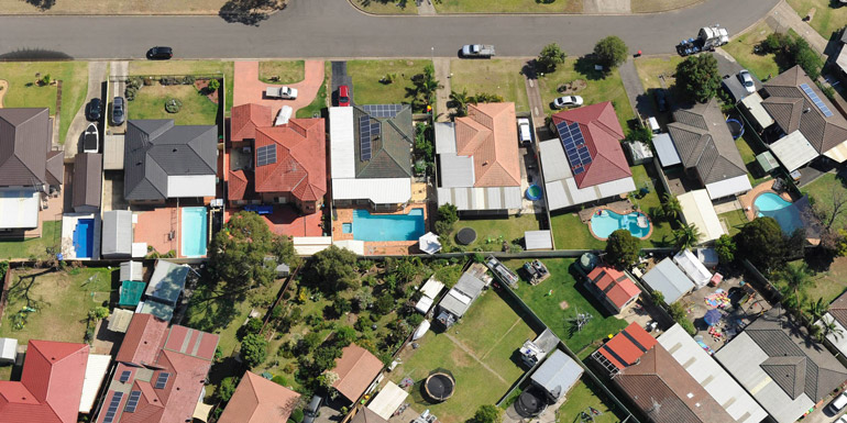
The impacts of heat are already being felt across Western Sydney as a combination of our natural geography, climate change and green fields making way for new housing developments exacerbate the ‘urban heat island effect’ and extreme heat.
Judith Bruinsma, Project Coordinator, Western Sydney Regional Organisation of Councils
Heat already kills more people in Australia than any other natural disaster, including floods, cyclones and bushfires. NSW Health research has found severe heatwaves in Greater Sydney cause an increase in mortality of up to 13%.
Western Sydney, home to more than 2.5 million people, is typically 6-10°C hotter than the rest of the city during extreme heat events. Climate modelling predicts that, by 2070, communities in Western Sydney will swelter through an additional 20 days of 35°C or more over the course of a year.
“Heat has cumulative and cascading impacts on our communities, economies and ecosystems,” says Western Sydney Regional Organisation of Councils (WSROC) Project Coordinator Judith Bruinsma. “But the decisions we make during planning and design can help us to mitigate these impacts.”
Across Australia, our urban spaces are heating up as buildings and hard surfaces absorb and radiate heat and as blue and green spaces make way for development. This creates what is known as the ‘urban heat island effect’.
Western Sydney is naturally hotter than Eastern Sydney and is often hit with hot westerly winds and less frequently cooled by sea breezes. Ongoing development means that the region also experiences a higher urban heat island effect than other parts of the city. Residents in Western Sydney consume double the energy for cooling than people in eastern suburbs of Sydney, for instance.
“Much of the focus to date has been on urban greening – but research shows that planting more trees won’t be enough,” says WSROC’s Judith Bruinsma.
While the evidence was clear, the Western Sydney Regional Organisation of Councils, or WSROC, identified the need for tools to translate that evidence into practical action. Bringing together scientists, academics and experts from its member councils, WSROC developed two new resources: the Urban Heat Planning Toolkit and the Cool Suburbs design support tool.
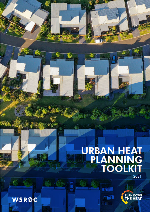
The Urban Heat Planning Toolkit
The Urban Heat Planning Toolkit helps local governments to strengthen their planning provisions to reduce the impacts of heat. The toolkit outlines design strategies – from cool roofs to green cover to sustainable water supply – that can help local governments as they plan and design, and also as they support their communities to adapt, survive and thrive in a hotter climate.
“The toolkit looks at the full scale of interventions possible to reduce urban heat and matches those up where local government has a role to play,” Judith says.
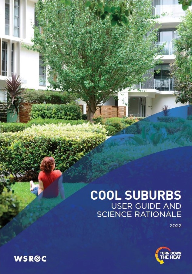
Cool Suburbs
In 2022 WSROC launched Cool Suburbs, a rating tool that guides best practice heat resilience in design and development. The tool can also be used for assessment and approvals, policy and planning.
A collaboration between WSROC, Resilient Sydney and the Greater Sydney Commission, Cool Suburbs was supported by an expert science panel with representatives from Monash University, Melbourne University, University of NSW, Western Sydney University.
“The expert science panel helped us to translate the best available urban heat science into a practical scoring system,” Judith says.
“Cool Suburbs fills a gap by synthesising urban heat science into one an easy-to-use platform.”
Cool Suburbs provides best practice guidance on everything from solar orientation to wind direction, cool materials to greenery.
The tool can support various scales of development – from individual lots to entire precincts – and guide all stages of the development process.
Credits guide the development of cool streets, for instance, that offer shade, suitable irrigation and porous pavements.
Cool homes are rewarded for passive cooling strategies, for example, for carefully considering shading from tree canopy or by selecting cool materials like light-coloured roofing that reflects rather than absorbs the heat.
At the master-planned community level, projects are recognised when streets are laid out to channel cool breezes, when existing tree canopy is retained, or when green and blue open space is designed to reduce local air and surface temperature and improve outdoor thermal comfort.
Most credits apply to the whole of Sydney and the state, but some specifics around wind and solar orientation are unique to Western Sydney and its climate zone.
WSROC specifically chose an Excel-based platform so that it could be easily integrated into other rating tools, like Green Star or BASIX in the future.
“We consider this a prototype, and we continue to test some of the credits, and to collaborate with our project partners to improve Cool Suburbs so we can scale it up nationally and embed it in existing rating tools and policy.”
Developers have already piloted Cool Suburbs and have shared positive feedback, and WSROC is now developing case studies to showcase the tool’s application on real world projects.
We want Cool Suburbs to be embedded into policy, practices and planning. Working with the development industry is the next step to make it happen
Judith Bruinsma, Project Coordinator, Western Sydney Regional Organisation of Councils
Both projects recognise that there is no single solution to the urban heat island effect, Judith adds.
“A combination of green space, permeable pavement, cool materials and water-sensitive design must work together. They are all interconnected. In the same way, councils, state governments, industry and the community must work together to adapt, respond and build our resilience to extreme heat.”
Neither the Urban Heat Planning Toolkit nor the Cool Suburbs tool are static. As more people and projects embrace cooling design solutions, and as planning systems adapt to address heat, our evidence base will grow and our tools will adapt and evolve.
Insights for local government
Strengthening local planning provisions can reduce the impacts of urban heat, but this is a new and complex space for local governments. Local provisions can include new standards for building exterior, landscaping and water sensitive design, for example.
“We are already seeing some councils use the toolkit to develop best practice standard clauses for Local Environment Plans and Development Control Plans, by setting targets for green cover, building materials and other measures that mitigate urban heat.”
While local governments can take action to reduce urban heat in their communities, heatwaves will still occur and will become more intense as our climate changes.
“We need solutions that address the urban heat island effect, but local governments also play an important role in building community resilience to heat. These resources help local governments to translate the science into useful strategies that do both.”
This project was proudly funded by the NSW Government.
Case studies
Ensuring there’s enough water in the moat may not be a common challenge for those preparing for changing climate conditions.
Climate change is a threat; but it is also a chance to connect. An imaginative project from artist-led gallery Pari brought together innovative arts practitioners and Indigenous knowledge holders to help communities of Western Sydney strengthen community connections and build resilience.

This collaboration between NSW DPI and the Redmap project demonstrates how marine species are responding to climate change and shows how citizen science can engage communities in conversations about climate adaptation.